Proton has published a searchable map of Flock Safety’s surveillance network, giving people a ZIP-code lookup and driving-route view of devices near their homes, workplaces and regular trips. The inventory behind the tool contains more than 170,000 cameras and over 130,000 other Flock devices, according to Proton’s description of the map.
The total is striking, but it needs a date attached to it. The map is a snapshot of Flock records retrieved in December 2025, not a live feed. Cameras installed or removed since then may be missing or shown incorrectly. It is best treated as a detailed historical inventory and a starting point for local verification, not a definitive count of what is operating today.
How to use Proton’s Flock camera map
The map accepts a ZIP code, street address or latitude and longitude. Readers can pan across an area, filter the displayed devices and enter a starting point and destination to see a driving route alongside mapped hardware. Proton says the page is intended to help people understand where license plate readers are located and decide whether to ask local officials about their deployment.
A pin on the map does not establish that a camera remains active. Proton explicitly warns that the underlying data is a December 2025 snapshot. Anyone checking a specific neighborhood should compare the result with recent city council documents, police department equipment lists, procurement records or a current crowdsourced map. A physical roadside sighting can confirm that hardware is present, but it still does not reveal whether the unit is powered, connected or sharing data.
The map also includes more than cameras. Proton breaks the inventory into over 170,000 cameras and more than 130,000 other devices. Reporting on researcher Joshua Michael’s database has identified networking equipment, integrations for third-party cameras and acoustic detection hardware among the additional records. That is why the roughly 300,000-device total should not be described as 300,000 license plate readers.
What Flock cameras collect
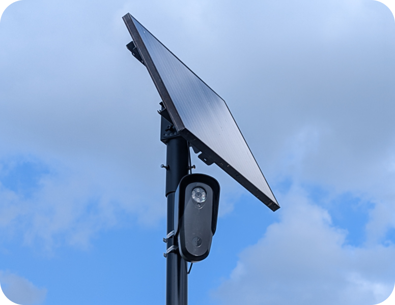
Flock’s automated license plate readers photograph passing vehicles, including vehicles not connected to an investigation. The records include a plate, time and location. The company’s Vehicle Fingerprint feature can also use characteristics such as make, model, color, dents and bumper stickers to find a vehicle when a plate is unavailable or unreadable, according to Proton’s summary of the system.
The records are uploaded to Flock’s cloud platform, where authorized customers can search them and, depending on their settings and agreements, share results with other agencies. Flock says its network handles more than 20 billion vehicle reads each month across 49 states. The company serves police departments as well as businesses, property managers, homeowners associations, schools and other organizations.
Flock has argued that customers own their data and choose who can access it. In August, amid sustained scrutiny, the company announced tighter controls for law enforcement users. Those changes include reducing the standard retention period from 30 days to seven, requiring searches to be connected to a case code, flagging emergency overrides and making an abnormal-search audit tool mandatory. The Associated Press reported that the measures are due to become mandatory by January 1.
Those controls do not settle the central policy question: whether a search should require outside approval rather than an officer or agency deciding internally. The AP documented criticism from civil-liberties and legal groups that want warrants, judicial checks and clearer limits on cross-agency access. The same report described both successful uses in serious investigations and cases in which officers were accused of searching for romantic partners, relatives or acquaintances.
Where the map data came from
Cybersecurity researcher Joshua Michael says he found that a Flock website exposed an access token without requiring a login in November 2025. He reported the issue, then used the token to query an ArcGIS system and retrieve device-location records. Proton says Michael’s inventory was captured the following month and that its page mirrors the resulting map rather than hosting or distributing the underlying dataset.
The origin matters because this is not a collection assembled solely from volunteers spotting poles beside roads. The coordinates came from records attributed to Flock’s own systems. Michael’s count of more than 170,000 cameras was roughly 40 percent above the approximately 120,000-camera figure that Flock had publicly cited, although the two totals may reflect different dates and counting methods.
Flock disputes the characterization that it was hacked or suffered a data breach. The access path was closed. Michael published his map in September 2026, and a brand-protection vendor filed a trademark complaint seeking its removal on Flock’s behalf. A cease-and-desist letter followed, according to the Foundation for Individual Rights and Expression’s account. Proton’s version places the public interface on its own infrastructure and makes it accessible outside the United States.
What to ask before trusting a local deployment
For residents, the map’s most useful role is to make better questions possible. A local agency should be able to state how many readers it operates, where they are installed, how long records are retained, which outside agencies can search them and whether every query is tied to a documented case. Officials should also be able to explain who reviews audit logs, what happens after a policy violation and whether federal or out-of-state searches are permitted.
Those answers can change even when the pole stays in place. A department may shorten retention, leave a regional sharing network, pause a contract or replace Flock with another vendor. Conversely, a camera absent from this snapshot may have been installed during 2026. Proton’s map makes the network visible at unusual scale; current local records are still necessary to understand who can search it now.
The map is evidence, not a live surveillance dashboard
The strongest conclusion supported by the data is not that every plotted device is operating today. It is that Flock’s deployment footprint was substantially larger and more varied by December 2025 than a camera-only public number suggested. The map also shows why oversight cannot stop at counting hardware: retention, sharing permissions, case requirements and audit enforcement determine how consequential each reader becomes.
Readers can use Proton’s Flock camera map to inspect an area, then verify current conditions through local public records and agency policy. That two-step approach avoids both extremes: treating a dated pin as real-time proof, or ignoring a detailed inventory simply because the network has continued to change.