Google has pulled back a new AI image-generation feature in Google Earth just one day after launching it, after users began sharing generated geospatial images that the company said appeared to violate its policies.
The feature, announced July 30, let Google Earth web users zoom to a location, tap “create image,” and use text prompts to generate custom visuals grounded in Google Earth’s satellite, aerial, and 3D imagery. Google framed the tool as a way to visualize history, real estate plans, possible building projects, and speculative future scenes. By July 31, an update on Google’s own announcement said the company was rolling the feature back while it worked on stronger guardrails.
“People uniquely trust Google Earth for a reliable view of the world,” Google wrote in the update, adding that generated images did not appear in the main Google Earth experience for other users and were watermarked as AI-generated.
What Google launched
The short-lived tool connected Google Earth with Nano Banana 2, Google’s image-generation model, so users could create prompt-based images from real-world locations. Google’s examples were benign: reconstructing ancient Pompeii for a classroom, turning an empty lot into a shopping district concept, adding a lakefront cabin to a property, or transforming the Google Mountain View campus into a future-looking scene.
That product idea is not hard to understand. Architects, planners, teachers, urban designers, and homeowners already use maps as a visual starting point. A generative layer inside Google Earth could make those sketches faster, especially for people who do not use professional GIS or 3D modeling software.
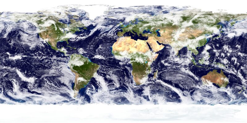
The problem is that Google Earth is not just another image canvas. It is a widely trusted reference tool for places. Journalists, researchers, open-source intelligence analysts, educators, travelers, and ordinary internet users treat satellite-style imagery as evidence of what is or was physically there. When a generative model is placed directly on top of that trust layer, even images that never enter the public Google Earth database can become persuasive once they leave the product as screenshots.
Why geospatial fakes are harder to contain
Coverage from TechCrunch and The Verge described the concern clearly: users and researchers quickly showed how the feature could be used to fabricate scenes that looked like satellite or aerial evidence of real-world events. Examples circulating in coverage included fake conflict damage, disaster scenes, refugee-related imagery, and sensitive-site scenarios.
Those images do not need to be perfect to cause damage. In breaking-news situations, a convincing screenshot can travel faster than verification. It can be cropped, recompressed, reposted without its original context, or mixed into a thread of real imagery. The viewer may not be evaluating the output as “AI art”; they may be evaluating it as a map-based claim about a place.
That is a different safety problem from letting users generate fantasy portraits or stylized product mockups. A fake satellite-style image borrows credibility from the interface and source material around it. It can look like a piece of documentary evidence, not a creative experiment.
Watermarks did not solve the sharing problem
Google’s rollback note emphasized two internal controls: generated images were watermarked, and they were not shown to other users in the main Google Earth experience. Those are useful baseline protections, but they do not fully address what made the feature risky.
The main distribution channel for misleading geospatial imagery is not necessarily the Google Earth map itself. It is the screenshot posted elsewhere: in a social feed, a messaging app, a news tip, a Telegram channel, a forum, or a slide deck. Once an image leaves the product, provenance has to survive cropping, scaling, recompression, screenshots of screenshots, and platforms that strip metadata.
That is why the rollback matters. Google did not say that the model itself was incapable of harmful output; it said the product needed stronger guardrails before the feature could remain available. In practice, that may require limits on prompt categories, restrictions around conflict zones and sensitive sites, visible in-image labels that survive casual resharing, clearer export controls, and stronger verification tools for journalists and researchers.
The deeper technical issue
Research on synthetic satellite imagery has already pointed to a structural challenge. A 2025 paper titled “Deepfake Geography: Detecting AI-Generated Satellite Images” argued that fake satellite images are harder to treat like ordinary deepfakes because terrain, texture, and structure create their own detection problems. The paper compared detection methods on more than 130,000 labeled images and found vision transformers outperforming convolutional neural networks in its test set, but it also framed the larger issue: satellite imagery is used in high-stakes scientific and security contexts, so authenticity matters.
Google Earth’s withdrawn feature brought that concern from research into a consumer product. The issue is not only whether an AI detector can catch a generated image later. It is whether a mapping platform should make the creation of believable geospatial fakes easy enough that detection becomes the backup plan.
What to watch if the feature returns
If Google brings the tool back, the important details will be more practical than promotional. The company will need to explain what counts as a blocked location or topic, whether sensitive-event and conflict imagery gets special treatment, how visible labeling works outside Google products, and whether generated images can be exported without durable disclosure.
Google should also clarify whether professional uses get different controls from ordinary consumer use. Urban planning, education, architecture, and environmental visualization are legitimate applications, but they may not need the same share-anywhere workflow that makes disinformation easier. A professional workspace with audit history, stronger labels, and controlled exports is a different product from a casual global image generator built into a map trusted by the public.
The fast rollback is a useful signal that Google recognized the trust problem quickly. It also shows how narrow the margin has become for AI features inside evidence-like products. A chatbot can be wrong and still feel like a chatbot. A map that can convincingly invent the world has to meet a higher bar.